| HOME | ABOUT US | MEMBER'S LOUNGE | SERVICES | LINKS | NEWS & EVENTS | REGISTRATION | GUEST BOOK | FEEDBACK & FAQ’S | CONTACT US |
| President’s Message |
||
| Executive Member's |
||
| Member’s Directory |
||
| Photo Gallery |
||
| News Letter |
||
| Advertisement | ||
| Best Wishes |
||
| ISRO And Its Major Missions - Shri R J K Jain | BACK ..... | ||||||||||||||||||||||||||||||||||||||||
R.J.K.Jain, Secretary, APCA |
|||||||||||||||||||||||||||||||||||||||||
The Indian Space programme born in the church at Thiruvananthapuram, the beginning of space activities in
the country, concentrate on achieving self reliance and developing capability to build and launch communication
satellites for television broadcast, telecommunications and meteorological applications; remote sensing
satellites for management of natural resources. For the past four decades, ISRO has launched more than 65 satellites for various scientific and technological applications like mobile communications, Direct-to-Home services, meteorological observations, telemedicine, tele-education, disaster warning, radio networking, search and rescue operations, remote sensing and scientific studies of the space. |
|||||||||||||||||||||||||||||||||||||||||
| The Indian Space Research Organisation (ISRO) has expanded to following 19 centers/ units with specialized activities of different nature in each centre . | |||||||||||||||||||||||||||||||||||||||||
|
|||||||||||||||||||||||||||||||||||||||||
ISRO has successfully operationalised two major satellite systems namely Indian National Satellites (INSAT) for
communication services and Indian Remote Sensing (IRS) satellites for management of natural resources; also,
Polar Satellite Launch Vehicle (PSLV) for launching IRS type of satellites and Geostationary Satellite Launch Vehicle
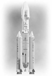
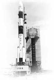
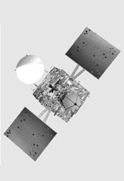
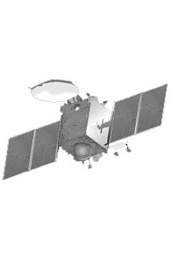
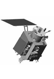
(GSLV) for launching INSAT type of satellites. Indian National Satellite (INSAT) System The INSAT series, commissioned in 1983, has today become one of the largest domestic satellites systems in the Asia-Pacific region comprising ten satellites in service. The present communication satellites are GSAT-12, GSAT-8, INSAT-4CR, INSAT-4B, INSAT-4A, INSAT-3E, INSAT-3A, KALPANA-1. Indian Remote Sensing (IRS) Satellite System The Indian Remote Sensing (IRS) satellite system is one of the largest constellations of remote sensing satellites in operation in the world today. The IRS programme commissioned with the launch of IRS-1A in 1988 presently includes eleven satellites . They are Megha – Tropiques, RESOURCESAT-1 -2, OCEANSAT-2, RISAT-2, CARTOSAT- 1 -2-2A -2B, IMS-1, TES. These satellites continue to provide imageries in a variety of spatial resolutions from better than one metre ranging upto 500 metres. Launch Vehicles Today, Indian space programme has become self-reliant with the operationalisation of two satellite launch vehicles, Polar Satellite Launch Vehicle (PSLV), mainly for launching IRS class of satellites in polar orbits and Geosynchronous Satellite Launch Vehicle (GSLV) for launching communication satellites into geo-synchronous transfer orbit. GSLV can carry 2- 2.5 tonne satellite into 36,000 Kilometer range for geo-stationery transfer orbit and India is the sixth country in the world to have this capability,so far . Polar Satellite Launch Vehicle (PSLV) It is the first operational launch vehicle of ISRO. PSLV is capable of launching 1600 kg satellites in 620 km sunsynchronous polar orbit and 1050 kg satellite in geo-synchronous transfer orbit. In the standard configuration, it measures 44.4 m tall, with a lift off weight of 295 tonnes. PSLV has twenty one consecutively successful flights out of twenty two launches. ISRO’s Polar Satellite Launch Vehicle, PSLV-C21 successfully launched SPOT 6 and PROITERES from Sriharikota (September 09, 2012) Geosynchronous Satellite Launch Vehicle(GSLV)-Mark I&II It is capable of placing INSAT–II class of satellites (2000 – 2,500 kg) into Geosynchronous Transfer Orbit (GTO). GSLV is a three stage vehicle. GSLV is 49 m tall, with 414 t lift off weight. It has a maximum diameter of 3.4 m at the payload fairing. First stage comprises S125 solid booster with four liquid (L40) strap-ons. Second stage (GS2) is liquid engine and the third stage (GS3) is a cryo stage. The vehicle develops a lift off thrust of 6573 kn. GSLV-Mk III The GSLV Mk III is conceived and designed to make ISRO fully self-reliant in launching heavier communication satellites of INSAT-4 class, which weigh 4500 to 5000 kg. The vehicle envisages multi-mission launch capability for GTO, LEO, Polar and intermediate circular orbits. GSLV Mk III is designed to be a three stage vehicle which is 42.4 m tall with a lift off mass of 630 tonnes. Satellite Applications Space has become the mainstay of national infrastructure providing vital services. INSAT with more than 210 transponders, is providing tele-communications, television broadcasting, weather forecasting and societal application services such as tele-medicine and tele-education . IRS System is providing data for a variety of application programmes such as Groundwater Prospects Mapping, Crop Acreage and Production Estimation, Potential Fishing Zone Forecast, Biodiversity Characterisation etc. In order to reach space-based services directly to the rural population, nearly 500 Village Resource Centres (VRCs) have been set up in association with NGOs, Institutes and Government Agencies. INSAT Applications The telephone circuit devices through INSAT connect remote inaccessible areas to major cities in India. The launch of INSAT-4A during December 2005, INSAT-4B in and INSAT- 4CR in 2007 have ushered in Direct To Home (DTH) television services in the country. Television reaches 85 percent of India’s population via INSAT. Over 200 AIR stations are linked via INSAT network. In the recent years, Very Small Aperture Terminals (VSAT) have revolutionised our telecommunications sector. INSAT supports over 20,000 VSATs for e-commerce and e-governance. National Stock Exchange and Bombay Stock Exchange use VSAT technology across the country for instantaneous transactions. Today exclusive channels are provided for interactive training and Developmental communication including distance learning. India has an exclusive meteorological satellite Kalpana - 1. The imaging instruments (VHRR) & (CCD) collect meteorological data and provide timely warnings on impending cyclones. The data relay transponder in the INSAT system is used for collect real time hydro meteorological data for river monitoring flow forces. The launch of EDUSAT on September 20, 2004 heralded new era in the field of distance education and today, about 35,000 class rooms are in the EDUSAT network providing services at primary, secondary and university levels. The satellite based telemedicine network has expanded its network connecting 375 hospitals (305 remote and rural hospitals including those in Jammu & Kashmir, North Eastern region and Andaman and Nicobar Islands, 13 mobile units and 57 super specialty hospitals in major cities). IRS Applications Imagery taken by Indian Remote Sensing (IRS) Satellite System has found application in diverse fields ranging from agriculture to urban planning. Crop health monitoring, crop yield estimation and drought assessment are the significant areas of application in the agriculture and the allied fields. Soil mapping at different scales with relative ease has become a reality. IRS data has also been used for Ground Water potential zone mapping and mineral targeting tasks. The ocean applications of IRS data include potential fishing zone identification and coastal zone mapping. Forest cover mapping, biodiversity characterisation and monitoring of forest fire is now carried out using IRS imagery. IRS spacecraft provide timely inputs to Flood and earthquake damage assessment thereby providing the necessary supportive strength to disaster management. Even in the field of Archaeological survey, the utility of IRS imagery has been well established. Village Resource Centre (VRC) Combining the services offered by INSAT and IRS satellites, a new concept namely Village Resource Centre (VRC) to provide information on natural resources, land and water resources management, tele-medicine, tele-education, adult education, vocational training, health and family welfare programmes has been established. Nearly 500 such VRCs have been established in the country. |
|||||||||||||||||||||||||||||||||||||||||
| Forthcoming Satellites and Missions:- | |||||||||||||||||||||||||||||||||||||||||
| The future ISRO vision is considering following objectives | |||||||||||||||||||||||||||||||||||||||||
|
|||||||||||||||||||||||||||||||||||||||||
INSAT-3D an exclusive meteorological satellite, is configured with advanced meteorological payloads - a 6 Channel
Imager, 19 Channel Sounder along with Data Relay Transponder and Satellite Aided Search & Rescue payloads. GSAT-6 spacecraft is configured with five S-band beams to cover the Indian main land, each beam supporting one CxS-band forward link transponder and ne SxC-Band return link transponder. Thus, the 5 beams will have paired five transponders. The communication link operates through a Hub. The payload uses a high power SBand TWTA and a new technology 6m unfurlable antenna. GSAT-7 is a multi-band satellite carrying payloads in UHF, S-band, C-band and Ku-band. The satellite weighs 2330 kg with a payload power of 2000W. The configuration of the satellite has been finalised and the design of new payload elements is completed. GSAT-9 will carry 12 Ku band transponders with India coverage beam and a GAGAN payload. The satellite is planned to be launched during 2013-14 by GSLV. GSAT-10 spacecraft, envisaged to augment the growing need of Ku and C-band transponders carries 12 Ku Band, 12 C Band and 12 Extended C Band transponders and GAGAN (GPS and GEO augmented navigation) payload. Subsystem fabrication and testing is in progress to realise the spacecraft for launch during 2012. GSAT-11 The payload configuration is on-going. It consists of 16 spot beams covering entire country including Andaman & Nicobar islands. The communication link to the user-end terminals operate in Ku-band while the communication link to the hubs operate in Ka-band. The payload is configured to be operated as a high data throughput satellite, to be realised in orbit in 2013 time frame. GSAT-14 is intended to serve as a replacement for EDUSAT as the spacecraft is configured with 6 Ku and 6 Ext C band transponders providing India coverage beams. In addition, the spacecraft also carries Ka band beacons,which are planned to be used to carry out studies related to rain and atmospheric effects on Ka band satellite communication links in Indian region. GAGAN Indian Regional Navigational Satellite System (IRNSS)-1, the first of the seven satellites of the IRNSS constellation, carries a Navigation payload and a C-band ranging transponder. The first satellite of IRNSS constellation is planned to be launched onboard PSLV during 2012-13 while the full constellation is planned to be realised during 2014 time frame. Chandrayaan-2 India’s second mission to the Moon, will have an Orbiter and Lander-Rover module. ISRO will have the prime responsibility for the Orbiter and Rover; Roskosmos, Russia will be responsible for Lander. Chandrayaan-2 will be launched on India’s Geosynchronous Satellite Launch Vehicle (GSLV-MkII) . The science goals of the mission are to further improve the understanding of the origin and evolution of the Moon using instruments onboard Orbiter and in-situ analysis of lunar samples using Lander and Rover. The Space Commission formulates the policies and oversees the implementation of the Indian space programme to promote the development and application of space science and technology for the socio-economic benefit of the country. DOS implements these programmes through, mainly Indian Space Research Organisation (ISRO), Physical Research Laboratory (PRL), National Atmospheric Research Laboratory (NARL), North Eastern-Space Applications Centre (NE-SAC) and Semi-Conductor Laboratory (SCL). The Antrix Corporation, a government owned company, markets the space products and services. The space activities in the country, concentrate on achieving self-reliance and developing capability to build and launch communication satellites for television broadcast, telecommunications and meteorological applications; remote sensing satellites for management of natural resources. |
|||||||||||||||||||||||||||||||||||||||||
|
|||||||||||||||||||||||||||||||||||||||||
| Email : apca2000@hotmail.com | |||